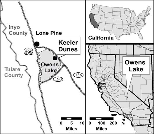
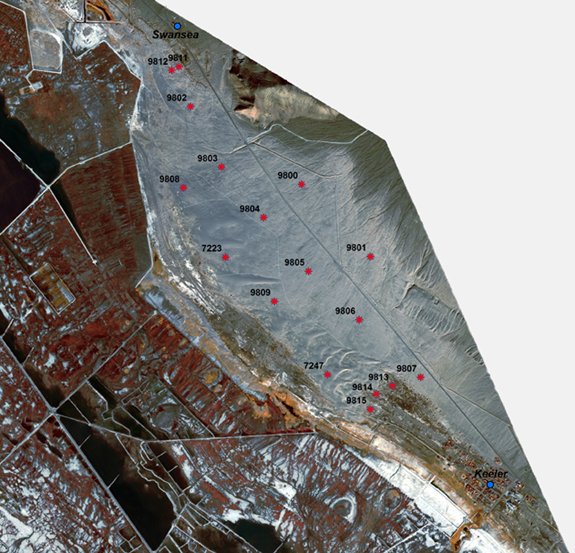
Keeler Dunes at Owens Lake
Overview
The Keeler Dunes and associated sand deposits are situated northwest from the community of Keeler on the Keeler alluvial fan east of the exposed bed of Owens Lake. The loose sands that compose the dunes and sand sheet are mobile and cause dust emissions during high wind events. The Keeler Dune area is one of the last main dust sources that cause and contribute to exceedances of the state and federal 24‐hour PM10 standard in the community of Keeler. As a result of these high PM10 concentrations, the Great Basin Unified Air Pollution Control District (District) identified the Keeler Dunes as one of the areas that need to be controlled in order to attain the PM10 standard within the Owens Valley Planning Area.
Background
Historic Owens Lake prior to water diversions of the Owens River and tributary streams had a surface area of approximately 110 square miles and a shoreline at an elevation of about 3,597 feet MSL. Following water diversion from inflow sources and a subsequent drop in the water level of the lake, large expanses of lake bed sediments were exposed. Due to the bathymetry of the lake bottom, the broadest expanses of exposed lake bed were in a 2 to 3 mile wide band that wraps along the shore of the eastern side of the lake bed. Large dust sources developed on the exposed lake bed creating high particulate concentrations within the region during high wind events.
One of the largest dust source areas, in terms of frequency, repeatability, and magnitude, was located on the north eastern portion of the lake bed in an area termed the North Sand Sheet . The soil composition in the NSS is predominantly sandy with the primary source of sediment from the Owens River and smaller component from the Inyo Mountains to the east of Owens Lake. With continual exposure to high winds since desiccation of the lake (in 1926), much of the sand in the NSS moved off of the lake bed forming a deposit of aeolian material on the adjacent alluvial fan (Keeler Fan). Reworking of the sands over time has caused the character of the sand deposit to change. Currently, the Keeler sand deposit is about 1.3 square miles in areal extent and appears to be spreading to the east and southeast toward the community of Keeler and the foothills of the Inyo Mountains.
Ground Based Photo Analysis - Full Report (1.7GB )
Keeler Dunes Historic Photographs and Current Retrographs (14MB .ppt)
Project Timeline
Due to the proximity to the community of Keeler, dust emissions from the Keeler Dunes contribute significantly to exceedances of the federal PM10 standard in the community. After all the lake bed sources are controlled, the Keeler Dunes area is expected to be the main remaining dust source that cause exceedances of the standard in the planning area. The District will work with the City of Los Angeles and other federal, state and local agencies to develop a plan to control dust emissions from the Keeler Dunes. PM10 control measures required for the Keeler Dunes will be ordered by the District before January 1, 2012 and implemented by the responsible parties before January 1, 2014 in order to demonstrate attainment of the federal standard by 2017.