Dust Controls
Best Available Control Measures (BACM)
Shallow Flooding
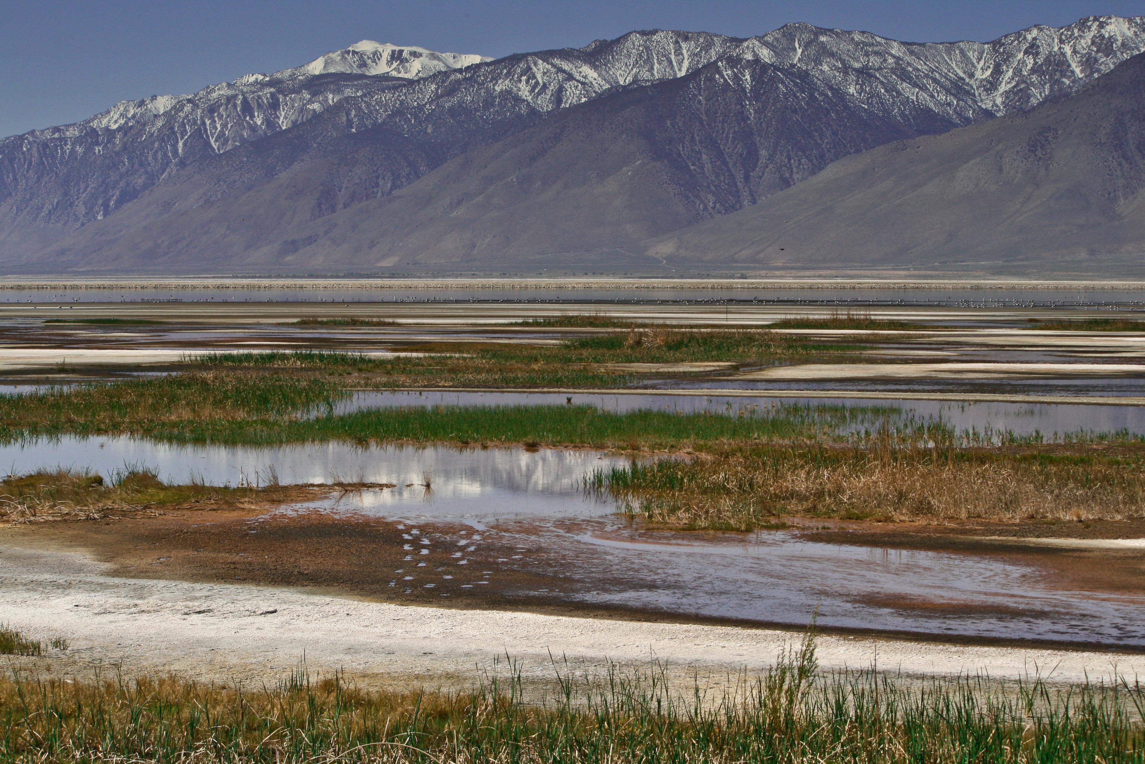
Shallow Flooding on Owens Lake
Between June 16 and July 31 of each calendar year, the City will supply, within the boundaries of the designated areas, water in amounts and locations adequate to maintain sources of food and water suitable for sustaining nesting and fledgling shorebirds, including western snowy plovers, nesting within the boundaries of those control areas or within ½ mile of their boundaries. If the control measure as implemented creates vegetation of the type and density used as wildlife habitat, the City shall supply water in amounts sufficient to maintain that vegetation in a state suitable for wildlife habitat during the period between June 15 and July 31 of each calendar year.
The City shall construct a berm keyed into the lake bed sediments along the lower boundary of each of the designated areas to minimize the transmission of excess water from the control areas toward the Owens Lake brine pool. The design and implementation of this berm will incorporate snowy plover crossings located at each 500 feet along the length of the berm, adequate in design to freely allow traverse of the berm by both snowy plover adults and chicks. Surface waters that reach the lower boundary of those control areas will be collected and recirculated for reapplication to the control areas. The control measure areas will have lateral boundary edge berms as necessary to contain waters in the control areas and to isolate the control measure areas from each other and from areas not controlled.
The City shall remove any exotic pest plants, including salt cedar (Tamarix ramosissima) that invade any of the designated areas. As necessary to protect human health, the City shall avoid or abate mosquito breeding and swarming in the control areas by effective means that minimize adverse effects upon adjacent wildlife.
Managed Vegetation
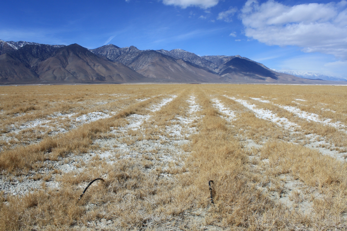
Managed Vegetation on the south end of Owens Lake
In areas designated for control by the Managed Vegetation control measure, the City shall achieve coverage of at least 50% on each acre in substantially evenly distributed live or dead vegetation, as measured by the point-frame method. The vegetation shall consist only of locally-adapted native species or species approved by both the District and the State Lands Commission.
The following portions of the designated areas are exempted from the requirement of 50% vegetative coverage:
- Portions consistently inundated with water, such as reservoirs and canals
- Roadways necessary to access, operate and maintain the control measure which are otherwise controlled to render them substantially non-emissive
- Portions used as floodwater diversion channels or desiltation/retention basins, (4) portions set aside as Transmontane Alkaline Meadow (TAM) habitat restoration zone as may be required to mitigate environmental impacts associated with the loss of existing TAM
The City shall remove any exotic pest plants, including salt cedar (Tamarix ramosissima), that invade the control area. To the extent necessary to protect human health, the City shall avoid or abate mosquito breeding and swarming in those control areas by means which minimize adverse effects upon adjacent wildlife.
To protect the control measure from natural flooding, the City shall incorporate drains and channels in the control measure area adequate to divert the flood waters away from the vegetated areas and to outlet the flood waters into the Owens Lake brine pool (or reservoir(s), if any). The drains and channels shall be designed to incorporate features (such as desiltation/ retention basins) adequate to capture the alluvial material carried by the flood waters and to avoid greater than normal deposition of this material into the Owens Lake brine pool.
The City shall construct a berm keyed into the lake bed sediments along the lower boundary of the designated areas to minimize the transmission of excess water from the control area toward the Owens Lake brine pool. The design and implementation of this berm will incorporate snowy plover crossings located at each 500 feet along the length of the berm, adequate in design to freely allow traverse of the berm by both snowy plover adults and chicks. Surface waters that reach the lower boundary of the control area will be collected and recirculated for reapplication to the control area or other discharge. The control measure areas will have lateral boundary edge berms as necessary to contain waters in the control areas and to isolate the control measure areas from each other and from areas not controlled.
Gravel
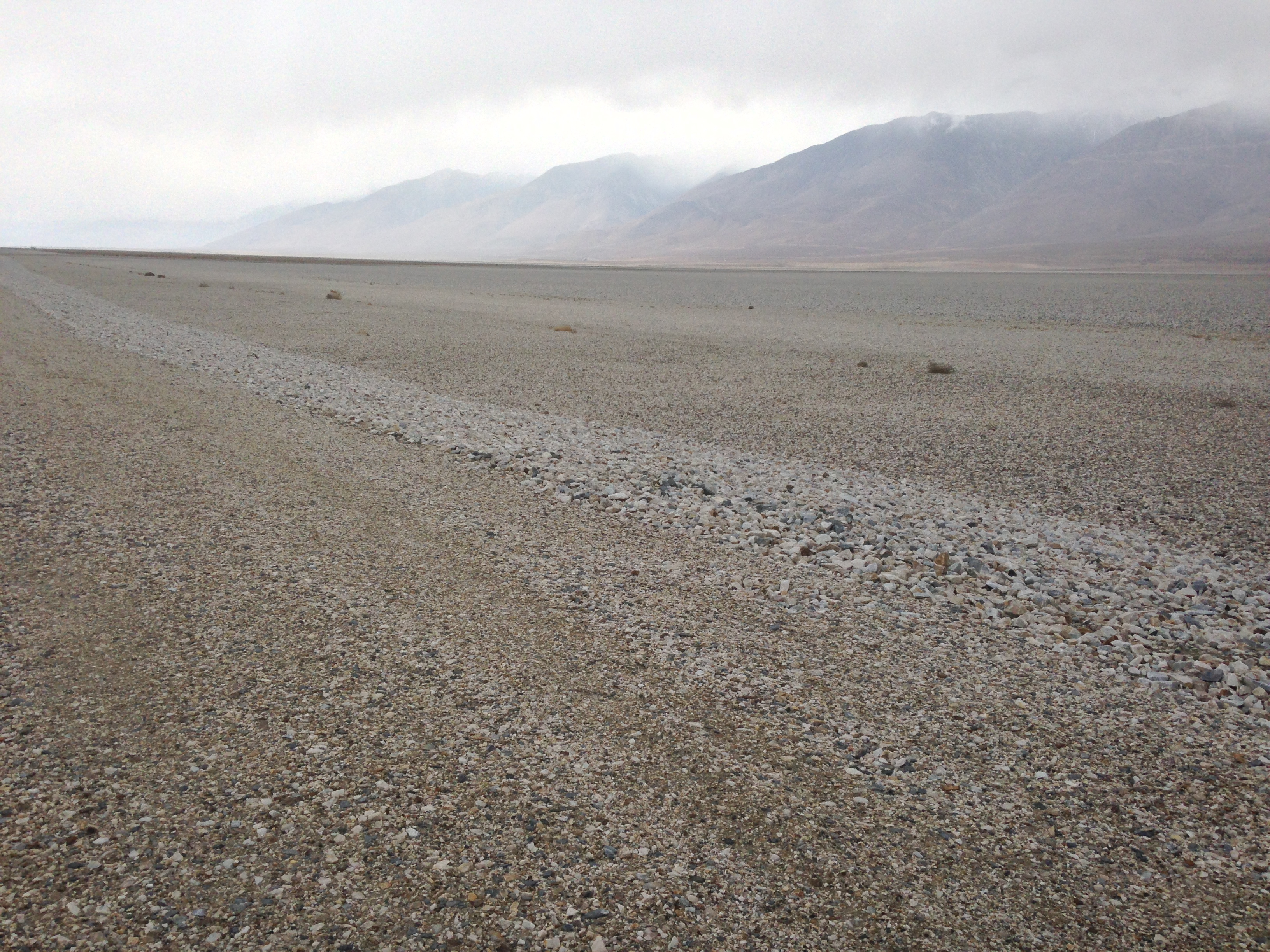
Gravel on the North end of Owens Lake
To protect the control measure from natural flooding, the City shall incorporate drains and channels in the control measure areas adequate to divert the flood waters away from the graveled areas and to outlet the flood waters into the Owens Lake brine pool. The drains and channels shall be designed to incorporate features (such as desiltation/retention basins) adequate to capture the alluvial material carried by the flood waters and to avoid greater than normal deposition of this material into the Owens Lake brine pool. The gravel placement design and implementation shall adequately protect the graveled areas from the deposition of wind- and water-borne soil. The City will apply best available control measures (BACM) and New Source Performance Standard (NSPS) emission limits to its gravel mining and transportation activities occurring in the District’s geographic boundaries as required by the District in the City’s District-issued Permit to Construct and Permit to Operate.